Größere Kartenansicht
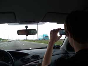 Auf dem Weg von Cardiff nach Bristol
|
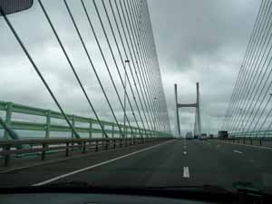 Die Brücke über den Bristol Channel: Second Severn Crossing
|
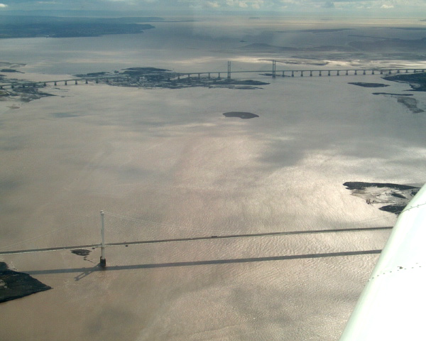 The Severn bridges crossing near the mouth of the River Severn (Wikipedia)
|
|
B - Bath
Bath ist eine Stadt im Westen Englands in der Grafschaft Somerset am Fluss Avon, etwa 20 km von der größeren Stadt Bristol entfernt. Sie ist berühmt für ihre römischen Bäder, welche ab dem Jahr 43 n. Chr. von den damals hier lebenden Römern aus den warmen Quellen entwickelt wurden. Es sind die einzigen heißen Quellen in England und der Überlieferung nach schon in vorrömischer Zeit bekannt gewesen. Seit der Zeit Elisabeth I. entwickelte sich Bath immer mehr zum Kurort der wohlhabenden Bevölkerung. Daraus resultierend befinden sich noch viele Gebäude, insbesondere aus der georgianischen Epoche in der Stadt. Eines der bekanntesten Bauwerke aus dieser Zeit ist der Royal Crescent. Bath ist von der UNESCO als Weltkulturerbe eingestuft. In dem gesamten Regierungsbezirk Bath and North East Somerset lebten 2001 knapp 170.000 Menschen, in der Stadt selbst leben etwa 86.000 Menschen, die sich selber Bathonians nennen. Mit der Universität Bath ist Bath eine Universitätsstadt. (Quelle: Wikipedia)
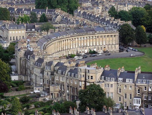 Royal Crescent ("königlicher Halbmond") in Bath (Wikipedia)
|
C - Taunton
Taunton ist der Hauptort und Verwaltungssitz der Grafschaft Somerset, England und gleichzeitig Verwaltungssitz des Bezirks Taunton Deane. Im Taunton-Deane-Tal gelegen, wird sie von den Hügeln der Quantock Hills, Black Downs und Brendons umgeben. Gegründet wurde die Stadt 710 vom angelsächsischen König Ine. Es wird aber vermutet, dass es in der Nähe schon vorher ein britisch-römisches Dorf gab. Der Name des Ortes leitet sich von Town on the river Tone oder Tone Town ab.
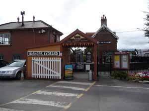
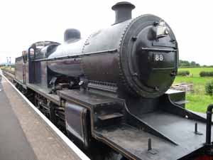
D - Bishops Lydeard Railway Station
Bishops Lydeard railway station is the southern terminus for regular trains on the West Somerset Railway, a heritage railway in Somerset, England. It is situated in the village of Bishops Lydeard. (Quelle: Wikipedia)
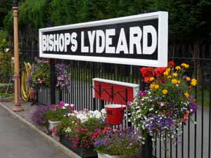 Bishops Lydeard Railway Station
|
|
|
|
E - Dunster Castle
Dunster Castle is the historical home of the Luttrell family located in the small town of Dunster, Somerset. There has been a castle at the top of the hill at Dunster for more than 1,000 years. The Domesday Book records one on this location before 1066. The castle was granted by William the Conqueror to William de Mohun, whose family lived there until the castle was sold in 1376 by Lady Joan de Mohun to Lady Elizabeth Luttrell. Lady Elizabeth's descendants owned Dunster Castle until 1976. The castle dominates a steep hill overlooking the picturesque village of Dunster. The hill has been fortified since Saxon times, although nothing now remains of these early defences. During the early medieval period the sea reached the base of the hill offering a natural defence, and strong walls, towers, ramparts and outworks protected the other sides. By the 15th century the sea had receded and the Luttrells created the deer park.
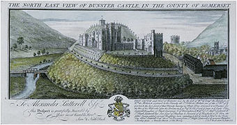 Dunster Castle, copper engraving by Samuel and Nathaniel Buck, 1733 (Wikipedia)
|
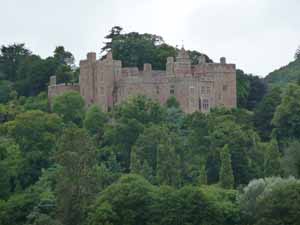 ...und heute
|
F - Minehead
Minehead ist eine Stadt an der Westküste Somersets (England) und ist mit rund 10.000 Einwohnern die größte Stadt der Exmoor Region. Minehead liegt direkt am Meer und ist ein typisches viktorianisches Seebad, das zwar seine beste Zeit hinter sich hat, aber immer noch Touristenziel ist.
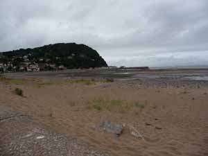
Der Strand von Minehead
Mit der Eisenbahn begann für Minehead die Zeit als Seebad. Die Quay Town, gelegen am Kiesstrand, bietet das, was man von einem englischen Seebad erwartet. Hier hat zur viktorianischen Zeit der Tourismus seinen Höhepunkt erlebt, als endlich eine Zugverbindung zum Wasser bestand. Eine Stadtrundgang durch die steilen Altstadtgassen zu den reetgedeckten Häusern rund um die Kirche ist empfehlenswert. In Minehead befindet sich der Startpunkt für den South West Coast Path. (Quelle: Wikipedia)
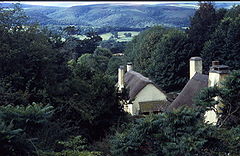
G - Selworthy
Selworthy is a small village and civil parish 5 kilometres (3 mi) from Minehead in Somerset, England. It is located in the National Trust's Holnicote Estate on the northern fringes of Exmoor. The parish includes the hamlets of Bossington, Tivington, Lynch, Brandish Street and Allerford. At 308 metres (1,010 ft) Selworthy Beacon, which is above the village, is one of the highest points on Exmoor. It is defined as one of the Marilyns in England. Near the summit are a series of cairns, thought to be the remains of round barrows, and the British Iron Age Bury Castle.
Selworthy (Wikipedia)
On the hill above the village is the whitewashed 15th-century Church of All Saints, with a 14th-century tower. The pulpit includes a 17th-century hourglass and the iron-bound parish chest dates from the same time. Within the church is a copy of the Chained Book of 1609 by Bishop John Jewel, entitled Defense of the Apologie of the Church of England.
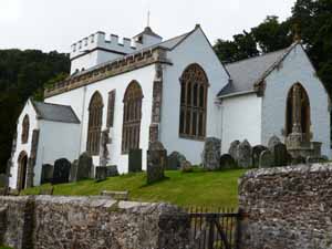
Church of All Saints
It has been designated by English Heritage as a Grade I listed building.[19] In the churchyard is a medieval cross with three octagonal steps, a square socket, and an octagonal shaft. The head is missing. The churchyard provides views across the valley to Dunkery Beacon.